Chapter One · Ranch Land
The Country Before the District
Until the mid 1980s, the land along Narcoossee Road in southeast Orange County was cattle ranch, citrus grove, pine flatwoods and wetland, with scattered homes only at Isle of Pines and around Lake Whippoorwill and Lake Hart. There was no district here, no town center, no hospital row. There was a road, a scatter of lakes, and country that Orlando had not yet reached.
The older settlement sat just south, in Narcoossee and St. Cloud. English settlers arrived there in the 1880s, and Joel T. Tyson and his family had settled in Narcoossee in 1849 as cattle ranchers, citrus growers and farmers. The names of that first settlement never left the map: many Lake Nona area road names, Tyson, Tindall, Jones, Jack Brack, Runnymede and Thompkins among them, are named after those early English settlers.
Access came late, and it explains the timing of everything that followed. Construction on State Road 417 began in 1989, and its Southern Connector opened in 1993. For most of its history, this corner of Orange County was ranch land partly because it was hard to get to. Once the expressway arrived, it stopped being far away.
Then and Now
Narcoossee Road is still the spine of the district, and the lakes that dotted the ranch land are still where they were. The open ground between them now carries the neighborhoods and the Town Center, and the guide's Boxi Park Lake Nona sits in the middle of what was pasture within living memory.
Chapter Two · Legend and Record
Miss Nona, and the Limits of the Record
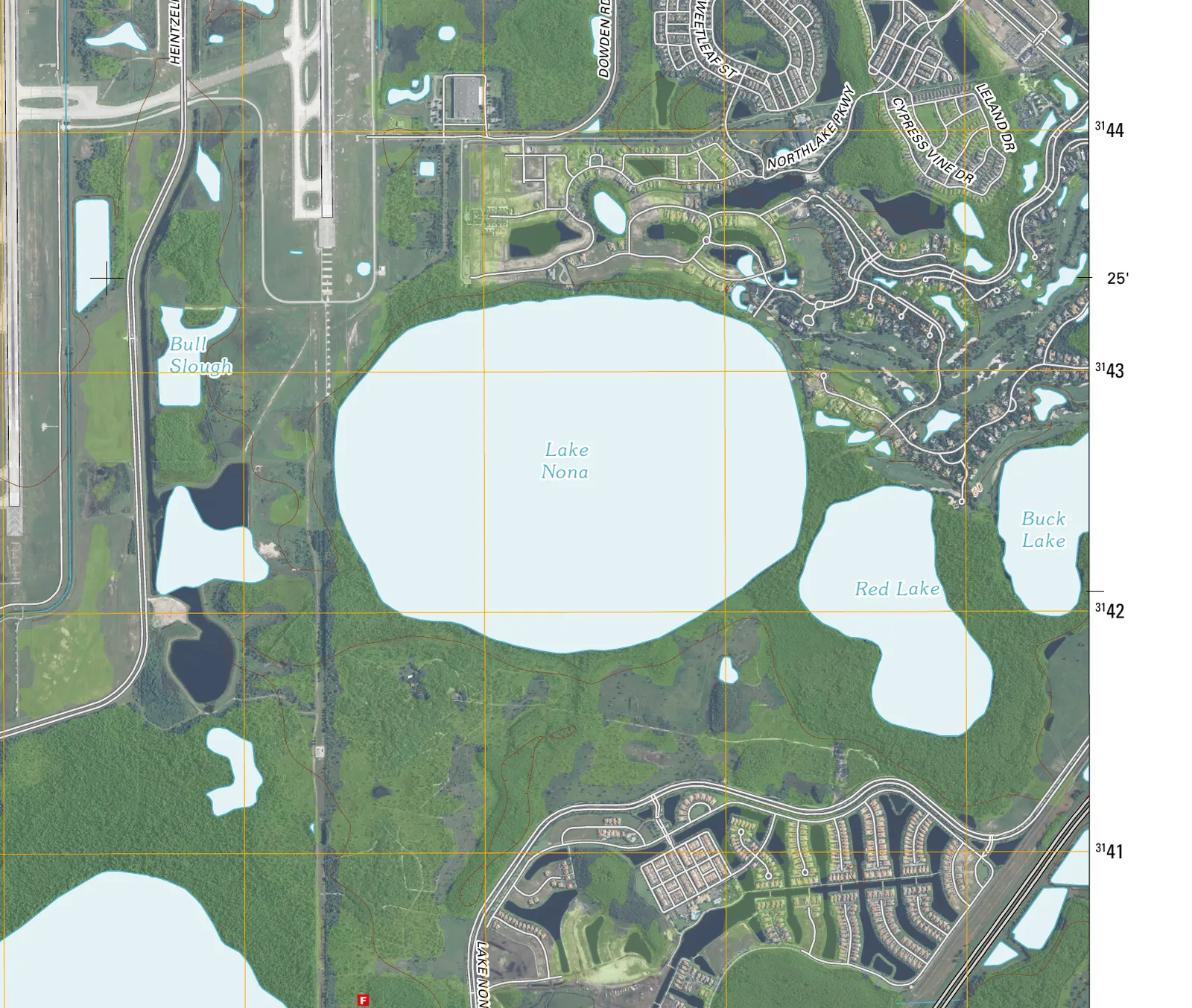
What is documented is that the community took the name of the lake, and the lake's name is older than the development. Lake Nona is a real lake, 587 acres in the Lake Hart watershed, and it carried that name on United States Geological Survey topographic maps, the Pine Castle quadrangle, long before anyone drew a master plan. Tavistock did not invent the name. It adopted one that was already on the federal survey record.
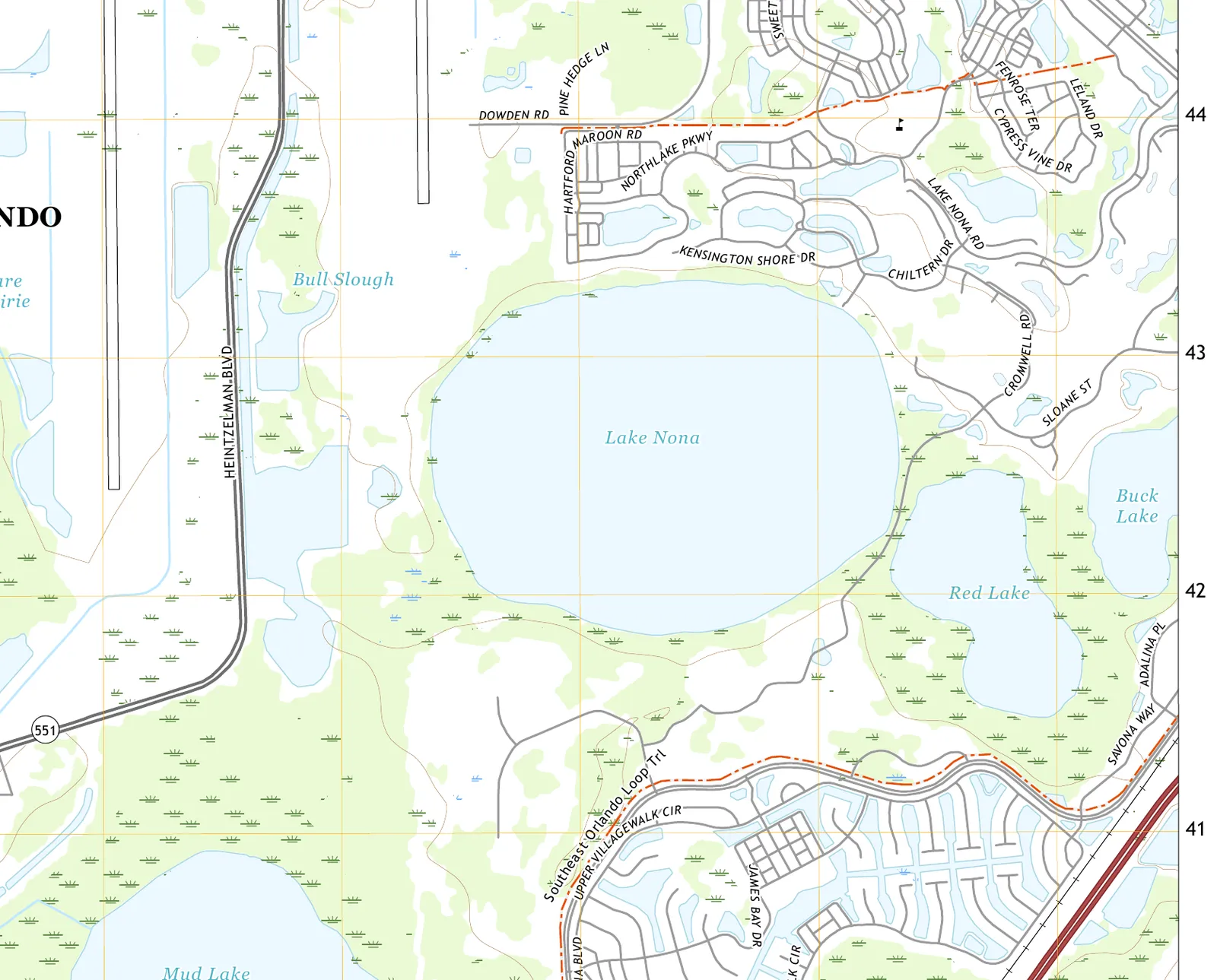
Who Nona was is not documented, and the story belongs in the legend column, labeled as one. Local tradition holds that the lake was named for a matriarch of one of the area's early homesteading families, remembered as Miss Nona. As far as any published source goes, there is no deed, no plat, no surname and no dates behind her. The documented origin stops at the lake name on federal survey maps, and the person behind Nona, if there was one, remains undocumented.
The research checked the other stories too. Family naming claims beyond Miss Nona, a Houghton or Carr ranch story among them, and a ninth lake claim were looked for in credible sources and are not documented either. This page prints the lake, the map, and the legend with its label on, and stops there.
Then and Now
The survey name now rides the whole district. It is on the guide's map from Lake Nona Deli and Market to Nona Adventure Park, and on Lake Nona Boulevard, the main internal arterial, all of it borrowed from a lake whose own name nobody can fully explain.
Chapter Three · 1986 to 1996
A Golf Course First, Then a Plan, Then a Buyer
Modern Lake Nona began with a golf course, not a hospital. Lake Nona Golf and Country Club opened for play in 1986, a Tom Fazio design on roughly 600 acres, built while the surrounding land was still pasture and before any expressway or master plan reached it. The club was serious from the start: it hosted the inaugural Solheim Cup in 1990 and the World Cup of Golf in 1993.
Planning and purchase followed a decade later. In 1995, the City of Orlando initiated its Southeast Sector Plan, the zoning and land use framework that designated the quadrant for large scale mixed use growth instead of leaving it agricultural. In 1996, the Tavistock Group acquired the golf club and about 4,000 adjoining acres, and grew its holdings over the years to roughly 7,000 acres. The community that resulted covers 17 square miles inside the Orlando city limits, southeast of Orlando International Airport.
Then and Now
The fairways came first and the city filled in around them. The pasture beyond the club now holds the Town Center, where the guide sends you to Canvas Restaurant & Market and Chroma Modern Bar + Kitchen, a short drive from greens that were mowed when there was almost nothing else here.
Chapter Four · 2005 to 2015
Medical City, the Hinge
Everything before Medical City is prologue. In October 2005, the Tavistock Group donated $12.5 million and 50 acres of land to the University of Central Florida to help establish a medical school at Lake Nona. On March 23, 2006, the Florida Board of Governors voted 15 to 1 to approve UCF's proposal to build a medical college here, and the school greeted its first students in fall 2009.
The buildings opened in a tight sequence on the 650 acre health and life sciences park. Sanford-Burnham's medical research institute opened in May 2009, alongside UCF's Health Sciences Campus. In 2012, the University of Florida Research and Academic Center opened, and Nemours Children's Hospital opened and began accepting patients.
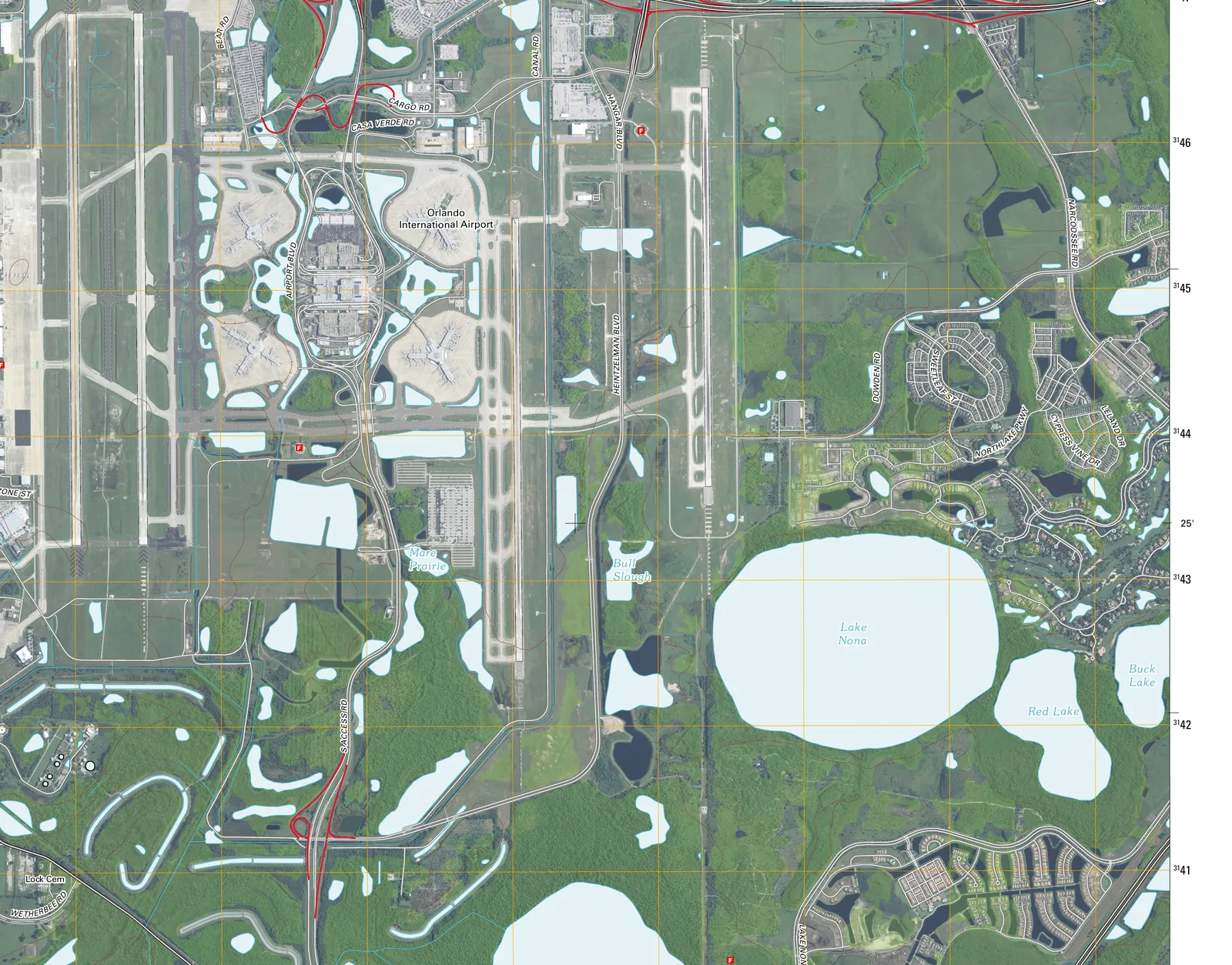
The quadrant from the air, USGS Pine Castle quadrangle, 2012 imagery edition. U.S. Geological Survey, public domain.
The Orlando VA Medical Center began seeing clinical patients in February 2015, completing the founding row: a medical college, a research institute, a university research center, a children's hospital and a veterans hospital, all planted within a few years on land that had been ranch and grove a generation earlier. Laureate Park, the residential enclave built to house the Medical City workforce, had opened in 2011, while the hospitals were still rising.
Then and Now
Medical City is a working district now, and it eats like one. The guide's Town Center tables, Park Pizza & Brewing Company, Nami and Bacán among them, feed the workforce the 2005 donation set in motion, in a neighborhood that did not exist when the century turned.
The Index in the Street Signs
How the Streets Got Their Names
A young district writes its street signs in the open: a Creek word on the old road south, a developer's name on the new boulevards, and one neighborhood whose streets are a roll of honor for science.
- Narcoossee Road: named for the town of Narcoossee, which the road serves. Narcoossee is a Creek word for a bear: one account glosses it little bear, another black bear, so this page prints Creek, bear, and the disagreement.
- Laureate Park's streets: genuinely named for past Nobel laureates. A Laureate Park account states that the gently meandering streets are named for past Nobel Laureates, and that developers hoped future Nobel Prize winners would ultimately live in the enclave built to complement Medical City.
- Tavistock Lakes Boulevard: the Tavistock element is the developer's name: the Tavistock Group purchased and developed Lake Nona, and its land company used this boulevard as its own address. The Lakes element reads as descriptive of the lake district, and no published statement spelling out the full compound name was found.
- Lake Nona Boulevard: descriptive, named for the lake and the community it serves. It is the main internal arterial, running southwest from Narcoossee Road past Town Center and Medical City, with its own SR 417 interchange.
- Medical City Drive: descriptive of Medical City, the 650 acre health and life sciences park. No separate namesake beyond the district name was found.
Randal Park, spelled with one L, has no published naming origin in the sources consulted, and guessing a Randall family name would be invention. It is a substantial neighborhood, planned at 700 acres, and its name simply has no documented story yet.
The Story, On Foot
Walk It Today
Start at the Town Center, the district's front room, and graze it the way the guide lays it out: Boxi Park Lake Nona for the open air, a table at Canvas Restaurant & Market or Chroma Modern Bar + Kitchen, pizza at Park Pizza & Brewing Company, and the dining rooms at Nami and Bacán when the occasion calls for theater with dinner.
Then go looking for the older layers. Nona Adventure Park puts you back on the water, the element this district was named for before it was built. Lake Nona Deli and Market keeps the neighborhood fed day to day. And a drive down Narcoossee Road, past the Tyson and Runnymede signs, runs you out of the newest district in Orlando along the oldest names it has.
Images and sources
Every archival image on this page is in the public domain. Follow any credit to its archive record.
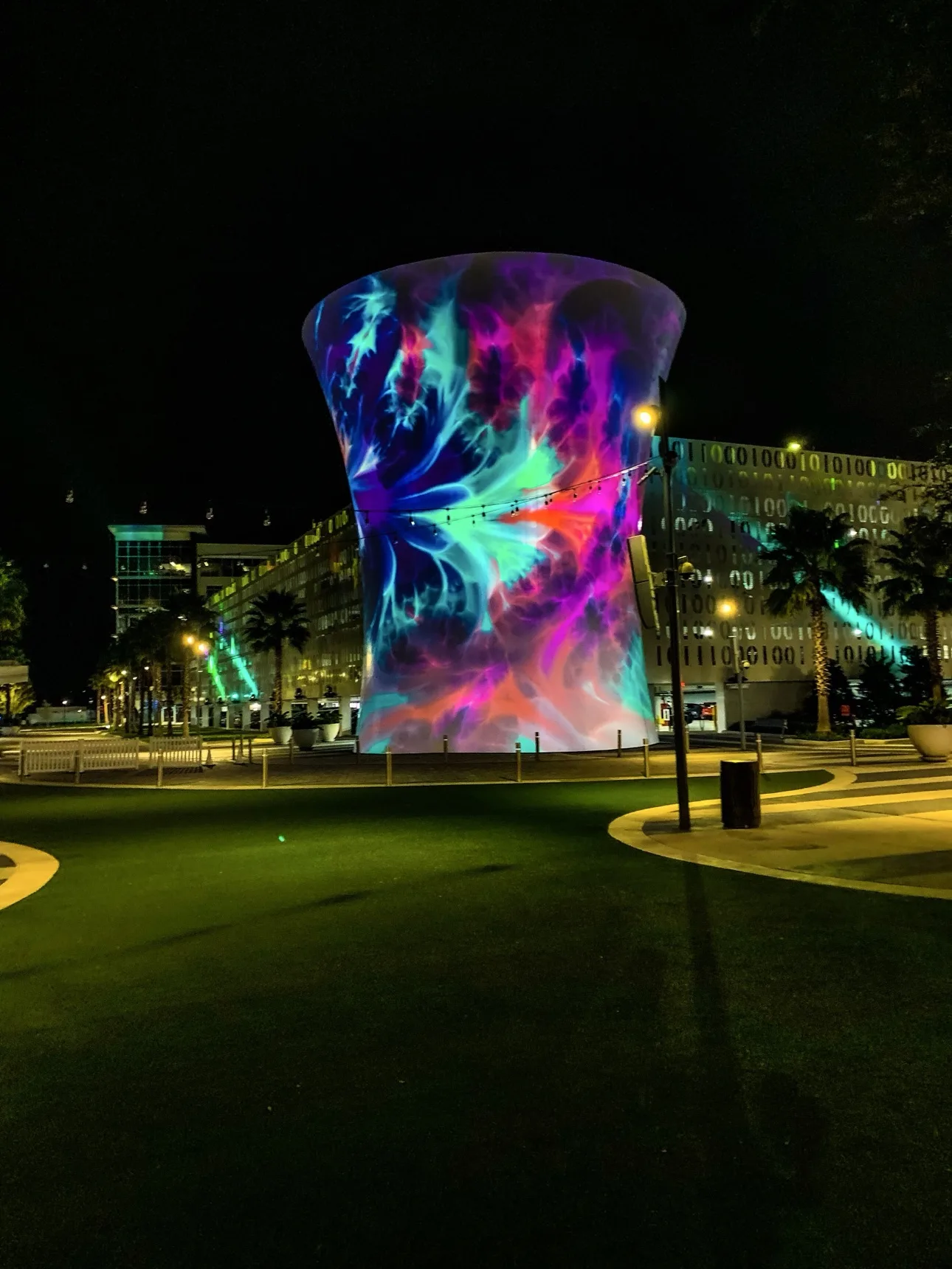
- The Beacon at night, Walk It Today: photograph by 407 FYI.
- Lake Nona aerial view, hero: U.S. Geological Survey, US Topo 7.5 minute map for Pine Castle, FL, 2012 imagery edition, USGS via The National Map. Public domain, a work of the U.S. federal government.
- Lake Nona topographic map detail: U.S. Geological Survey, US Topo 7.5 minute map for Pine Castle, FL, 2021 edition, USGS via The National Map. Public domain, a work of the U.S. federal government.
- Southeast quadrant aerial view: U.S. Geological Survey, US Topo 7.5 minute map for Pine Castle, FL, 2012 imagery edition, USGS via The National Map. Public domain, a work of the U.S. federal government.
Story sources: the 407 FYI district histories research dossier, including the Lake Nona history assembled for it, the University of South Florida Water Atlas, and the U.S. Geological Survey topographic record. The sourced district history, street by street, lives on the District Histories page.