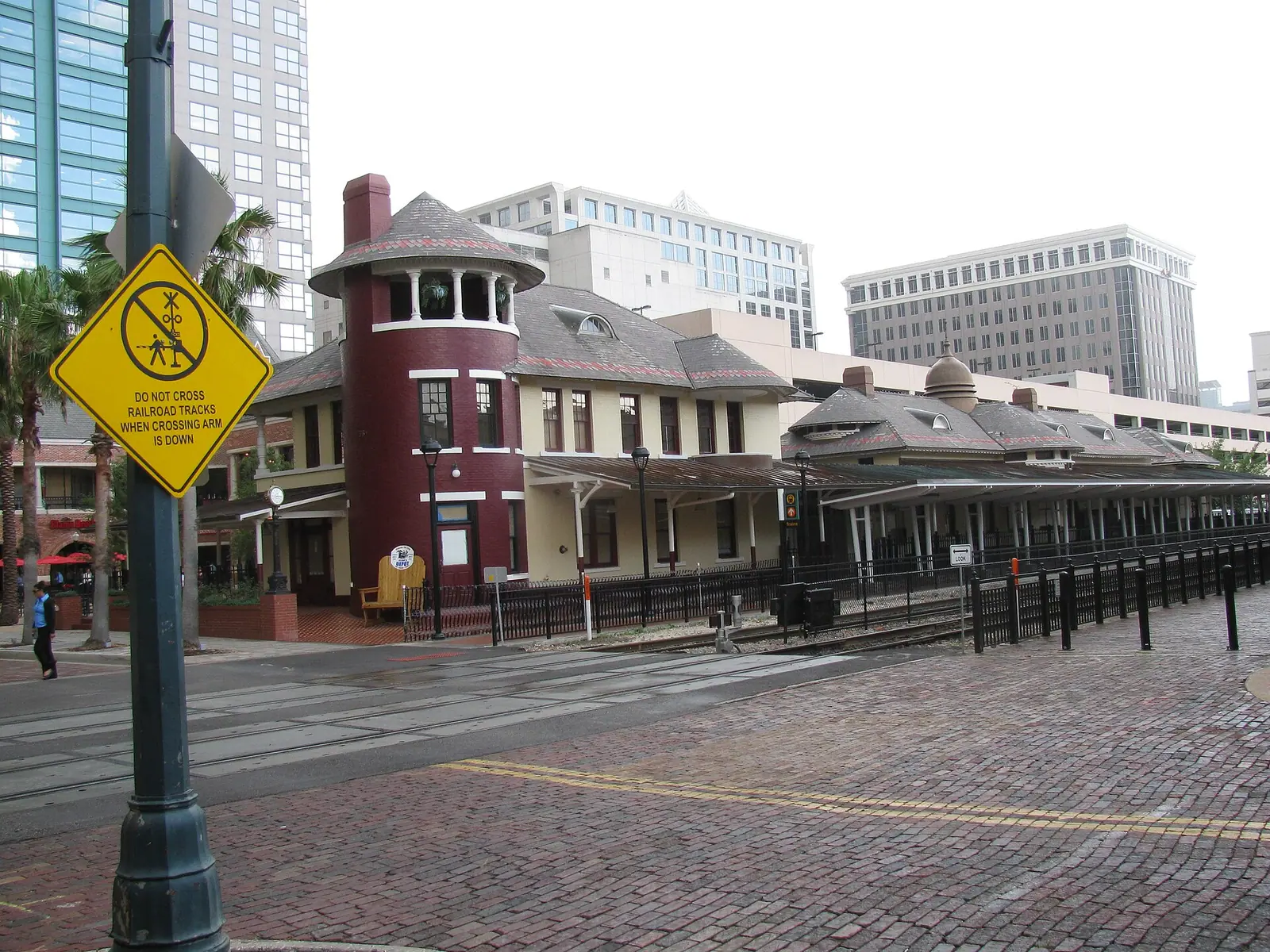
The Winter Resort
Winter Park
A town invented on purpose, sold to Northerners as a park to spend the winter in, and named exactly like it.
Settlement started small: in 1858 David Mizell Jr. and his family bought eight acres between Lakes Virginia, Mizell and Berry, and the settlement that grew around their homestead was called Lake View. In 1870 the name changed to Osceola and a post office opened. The South Florida Railroad reached the area in 1880 and set off a land boom along the line.
The modern town dates to 1881. Loring Chase first saw the area in February of that year and, with his Massachusetts boyhood friend Oliver Chapman, bought 600 acres for $13,000. By late summer they had platted a town: a grid of streets, a 10 acre park next to the railroad tracks, a lakeside resort hotel site, and a Black residential district for the domestic servants and grove workers the resort economy ran on. The Winter Park History Museum describes their goal as a planned community of winter homes for wealthy Northerners, and calls it the first planned community in Florida. Rollins College arrived in 1885, named in honor of Alonzo Rollins, a Chicago industrialist whose leadership gift of land and money came to $50,000, and the resort era peaked early: the Seminole Hotel opened on New Year's night 1886 with gas lights, steam heat, an orchestra and long covered porches.
Winter Park incorporated as a town in October 1887, and the History Museum notes that Hannibal Square residents, rallied by Gus Henderson, voted to include their neighborhood within the town limits, and that their vote was the deciding factor in the incorporation election. The town became the City of Winter Park in 1925. The back to back Great Freeze winters of December 1894 and February 1895 destroyed the citrus crop and the town's finances with it. Recovery was shaped by Charles Hosmer Morse, who settled here in 1904, bought hundreds of acres, and endowed the town with land for Central Park, a golf course and its clubs.
The name
The city tells this one directly. The settlement was Lakeview in 1858, Osceola in 1870, and in 1881 Chase and Chapman, kicking the name around in an informal discussion, decided they wanted something about a park in winter. Winter Park is a literal description of the product being sold: a park like town for the winter season.
How the streets got their names
- Park Avenue: named for the park it borders. The 1881 plat set a 10 acre park beside the railroad tracks, and Central Park still sits on the avenue's west side.
- Morse Boulevard: named for Charles Hosmer Morse, the Chicago industrialist behind the Fairbanks Morse Company, who made his home here in 1904, bought hundreds of acres and deeded Central Park to the town. His name is also on the Charles Hosmer Morse Museum of American Art.
- New York Avenue: a state name. The History Museum records that winter residents named streets after the states they left.
- Pennsylvania Avenue: a state name, from the same History Museum list of streets named for the home states of northern winter residents.
- Minnesota Avenue: a state name, from the same list.
- Georgia Avenue: a state name, from the same list.
- Virginia Avenue: a state name, from the same list.
- Fairbanks Avenue: named for Franklin Fairbanks, whose father and uncle founded the E. and T. Fairbanks scale company in 1824. Franklin became its president in 1888 and was a seasonal resident and property owner in Winter Park.
- Comstock Avenue: for William C. Comstock, a Chicago grain merchant who in 1885 became a director of the Winter Park Land Company, in charge of laying out roads, railways and buildings, and a charter trustee of Rollins College.
Two famous names stay undocumented. No source consulted says who named New England Avenue, likely as it sounds, and the Interlachen name, often explained as between the lakes or as a nod to Interlaken in Switzerland, is repeated as a likelihood by real estate writing, not documented by a city or museum source. Knowles Avenue likely honors Francis Bangs Knowles, the Rollins benefactor behind Knowles Hall in 1886 and Knowles Memorial Chapel in 1932, but the street's own naming record was not found.
Eat and drink your way through it: the Winter Park district guide.
The City Itself
Downtown Orlando
A courthouse town that became a citrus hub, then a skyline, and the one district whose own name nobody can prove.
Downtown grew south of Fort Gatlin, established in 1838 during the Second Seminole War. The area was renamed Jernigan in 1843 after first permanent settler Aaron Jernigan, became the county seat in 1856, and was renamed Orlando in 1857. Judge James Gamble Speer offered four acres for a courthouse and town square, the official plat was filed as the Town of Orlando, and the town incorporated in 1875. The South Florida Railroad was completed from Sanford to Orlando in 1880, and the small community boomed with land speculators, citrus and cattle investors, and tourists.
The years 1875 to 1895 were Orlando's Golden Era, when it became the hub of the nation's citrus industry, before a three day freeze in 1894 destroyed nearly all the citrus trees in Orange County and set recovery back about 15 years. The 1920s land boom gave downtown its first skyline: the Angebilt Hotel opened in March 1923 at 37 North Orange Avenue and broke height records, and the former bank buildings at 1 North Orange and 100 South Orange followed in 1924. Church Street holds the railroad era and the entertainment era in one block: the Old Orlando Railroad Depot of 1889, bought by entrepreneur Bob Snow in 1972, anchored Church Street Station, which by 1985 drew 1.7 million visitors a year and ranked as the state's fourth largest tourist attraction after Walt Disney World, SeaWorld and Busch Gardens. The modern towers came in two waves: the Citrus Center, completed in April 1971, was the first modern skyscraper in Orlando and held the tallest title for sixteen years, and 200 South Orange, completed in 1988 at 441 feet, is still described as the tallest multistory building in the city.
Lake Eola anchors the core's east side. Jacob Summerlin arrived in 1873 to buy 200 acres in what is now downtown, his family donated a strip of land around the lake for public use in 1883, and Lake Eola was recognized as a city park in 1888. Mayor E. Frank Sperry gifted the Sperry Fountain and its land in 1914, and the tiered fountain at the lake's center was built in 1957 as the Centennial Fountain and renamed the Linton E. Allen Memorial Fountain in 1966.
The name: the story Orlando tells itself
The Florida Department of State says it flatly: the town was renamed Orlando in 1857, and the true origin of the name remains a mystery. What circulates instead are legends, and this page labels them that way.
Legend one is the soldier. The popular story holds that a soldier named Orlando Reeves was killed in the Second Seminole War, in some versions while firing a warning shot, and that the place became known as Orlando's grave. The record disagrees: muster rolls show no Orlando Reeves, Reed or Jennings ever serving in the Seminole Wars, and military records report no soldier deaths in what is now Orange County. The legend was still carved in stone, literally, when Cherokee Junior High students placed a monument to Reeves at Lake Eola Park in 1939.
Legend two is the real man with the similar name. Orlando Savage Rees did exist, with a large volume of documentation placing him in Florida in the 1830s and a plantation venture at Spring Garden in Volusia County. His descendants came forward in the 1950s with a family legend that the city was named for him, and that the famous tree carving was his camping marker, not a grave. An eyewitness, Kena Fries, remembered the carving reading "Orlando Re-s," with the middle of the last name illegible and the missing letters presumed to be "eve."
What is documented is narrower, and better. Judge Speer proposed the name Orlando at a town meeting. Speer was a Shakespeare fan. The area south of Lake Eola was a popular camping spot on the Fort Mellon to Fort Gatlin Road between 1835 and 1856, with a large tree that had "Orlando" carved into it, treated by early settlers as a landmark. In 1857 the United States Post Office accepted Orlando as the official name. The Shakespeare theory, that Speer named the town for the hero of As You Like It, is the version his own descendants repeat and the one the 1915 book Early Settlers of Orange County prints, and it stays a theory, not a record.
Lake Eola's name is legend too, in two versions that do not agree. The City's telling: the lake was known to the public as Sandy Beach, and in 1883, when the Summerlin family donated its strip of land, Sandy Beach was renamed Lake Eola in memory of Robert Summerlin's dearly departed sweetheart. The Orlando Land Trust's telling, retelling Eve Bacon's history, says brothers Robert and Samuel Summerlin gave the name Eola to what folks also called Sandy Beach, that Sam suggested it, the name of a girl they both knew, and that when Sam was asked about the lady later, he said he just did not recall. Who Eola was, sweetheart, fiancee or friend, is not settled by these sources, and this page will not pretend otherwise.
How the streets got their names
- Orange Avenue: named, in one sourced historic district account, because it originally dead ended at an orange grove at the north end of town, during the citrus Golden Era. The simpler claims, that it honors Orange County or the citrus industry in general, were not documented in the sources consulted.
- Church Street: not for the church you would guess. A UCF RICHES exhibit notes that the old First Presbyterian Church visible from Church Street is not where the name came from: it came from the old Free Church School a block away, and Orlando Remembered dates that Free Church and school house to 1872.
- Magnolia Avenue: downtown's Main Street until the name changed. Main Street ran straight through downtown and was renamed Magnolia Avenue in the late 1950s. Why Magnolia was chosen is not documented.
- Rosalind Avenue: named in 1919, and not directly for Shakespeare. The street was Speer Avenue first, then West Street, then Rosalind, after the Rosalind Club, a women's social club founded in 1894, moved its headquarters there. The club's own name was the Shakespeare reference, Rosalind being Orlando's pairing in As You Like It, so the link is real, indirect, and dates to 1919 rather than 1857.
- Robinson Street: named for Samuel Robinson, city and county surveyor. A RICHES postcard note adds that East Robinson was named for Samuel Robinson of Emmett, Michigan, who surveyed for Orange County for seventeen years.
- South Street: named for its location, as the original southern boundary of the city.
- Central Boulevard: originally Central Avenue, documented on a 1919 postcard at Court Avenue. The tidy explanation, that it marks a central east to west dividing line, is plausible and undocumented.
- Colonial Drive: before it was Colonial it was Sweet Avenue, named for an old mayor. The Colonial name is attributed, in an essay citing a 1954 Corner Cupboard account, to Jeanette Robinson Murphy, daughter of an early settler, who heard the dirt road was to be paved and imagined it lined with stately Colonial mansions. The SR 50 number dates to the 1945 state renumbering. No source consulted documents a colonial era route behind this name, so that story is not repeated here as fact.
Pine Street, Amelia Street, Livingston Street and Marks Street are all old downtown names with no documented origin in the sources consulted. They are simply old, and old is all the record says.
Eat and drink your way through it: the downtown Orlando district guide.
The Intersection
Mills 50
The rare district whose name is just its address: Mills Avenue at State Road 50.
Mills 50 is a commercial corridor about a mile northeast of downtown, organized around one intersection. The district's own Main Street organization notes that the blocks around Colonial and Mills were a storefront retail shopping area in Orlando's early years, and that many of the historic buildings still stand, sidewalk canopies intact. The residential frame is Colonialtown: its earliest subdivision was platted in 1883, Colonialtown North was platted in 1911 as Highland Grove by developer H. Carl Dann, Dann's 1925 addition expanded the neighborhood to Colonial Drive, and Colonialtown South was designated a local historic district in 2000.
Mid century anchors are documented to the day. The Vogue Theatre at Colonial and Mills opened on Christmas Day 1940. The lumber company founded in 1933 as Central Florida Lumber and Supply at North Mills and Nebraska took its famous name, Mills and Nebraska, in the early 1950s from a marketing campaign built on that address. The defining modern era is Vietnamese resettlement: after the Vietnam War, the Catholic Charities refugee program began settling families in Colonialtown, one family's supermarket success grew into a hot spot of Asian American owned businesses around the intersection, and the area became known as Little Saigon, or Little Vietnam. The district's own overview calls the active Asian community its cultural cornerstone. The Mills 50 name itself arrived with the Main Street era: Orlando Main Streets was created by the city in 2008, and the name took hold around the time the old lumber yard was sold to be developed as Mills Park. Before Mills 50, the same ground also went by ViMi, for Virginia Drive and Mills Avenue.
The name
The district's own account is explicit, and it is the source to use: "Taking our namesake from the intersection of Mills Ave (17-92) and State Road 50 (Colonial Dr.), Mills 50 Main Street is a centrally located, unpretentious, urban district." Mills is the avenue, 50 is the state road number. The name is an intersection address, not a person, a founding year, or a business.
How the streets got their names
- Mills Avenue: nobody knows, on the record. The research behind this page checked city, library, history center and magazine sources and found the avenue's roles documented, its namesake nowhere. Local lore candidates for a settler or official named Mills were confirmed in none of them. Until a plat, city directory or newspaper source surfaces, any Mills namesake is a guess, and this page does not guess.
- Colonial Drive: the full telling is in the downtown lesson: formerly Sweet Avenue, the Colonial name attributed to Jeanette Robinson Murphy imagining stately Colonial mansions along the newly paved road, and the 50 itself dating to the 1945 state renumbering.
- Bumby Avenue: named for Joseph Bumby, homesteader and businessman, whose name runs the length of the east side. Bumby came from England in 1873, sold hay, grain and fertilizer from a Church Street warehouse that served as the depot when the railroad arrived in 1880, founded the Bumby hardware stores, and built the Bumby Hardware building in 1886.
- Fern Creek Avenue: named for Fern Creek, the waterway east of the corridor. The Florida Historical Marker for Dickson Azalea Park describes the park beginning as a natural stream, later named Fern Creek, in a deep ravine surrounded by native ferns, palms and oaks, which is the best sourced account of the creek's own name as well.
- Thornton Avenue: its north end runs into Mills 50. The namesake is developer James Thornton of the 1913 Thornton Park plat, told in the Thornton Park lesson.
- Virginia Drive: the story that the streets around here were named for a developer's family members circulates locally, but no source consulted documents it for Virginia Drive. What is documented is the street's early fabric: two grocery stores stood on it in 1924, and in 1926 it became the first street in the Lake Formosa neighborhood to be paved with bricks and get streetlights.
Hillcrest Street and Park Lake Street also have no documented naming in the sources consulted. Park Lake sounds descriptive, a street by Park Lake, and descriptive is all that can honestly be said.
Eat and drink your way through it: the Mills 50 district guide.
The Dairy
The Milk District
A whole district named after a dairy, which was named after a man, his wife, twenty acres and one cow.
The dairy came first, in 1925, on what was then the outskirts of Orlando. Thomas Gilbert Lee and his wife Elizabeth started T.G. Lee Dairy with the inheritance Lee received from his father Charles: twenty acres of land, one cow and a banknote. The company's own story page gives the cow her due: "One cow and 20 acres of land was all it took for Thomas Gilbert Lee and his wife, Elizabeth, to start what is now Central Florida's largest dairy, and it all started with a family cow named Hopper." In 1934 Lee turned the land into one of Orlando's first attractions, a dairy milking parlor where crowds gathered to watch cows being milked by machines. The plant that grew at 315 North Bumby Avenue later processed more than 230,000 gallons of raw milk a day.
By the 1950s the surrounding blocks had a working commercial character. Colonial Plaza opened on January 31, 1956 at Colonial and Bumby as one of the first regional shopping hubs in Central Florida, on 45 acres the dairy had occupied. Ronnie's Delicatessen ran from 1956 to 1995. The Plaza Theatre opened in 1963 as Orlando's first twin screen movie house and survives as Plaza Live. Beefy King has been family run on Bumby since 1968. Dairy farming itself wound down, processing continued, and in 2020 Dairy Farmers of America bought the Bumby Avenue plant as part of its purchase of Dean Foods facilities. The district name was formalized in the Main Street era: on October 10, 2016, City Council approval made The Milk District the tenth Orlando Main Street district. Its food truck era runs alongside: Tasty Takeover, Orlando's original weekly food truck event, has gathered in the district since 2011.
The name
Plain and documented: the district is anchored by, and gets its name from, the T.G. Lee dairy at its center. The area of independent businesses around the dairy's headquarters was known colloquially as The Milk District long before the name was made official in 2016.
How the streets got their names
- Bumby Avenue: named for Joseph Bumby, homesteader and businessman, founder of the Bumby hardware stores. The T.G. Lee plant stood at 315 North Bumby and Beefy King at 424 North Bumby, which makes Bumby the district's spine in both its dairy and dining eras.
- Robinson Street: named for Samuel Robinson, city surveyor. There is a fine twist on the record: on July 4, 1912, Alderman Samuel A. Robinson addressed the City Council on street naming and urged eliminating personal names, a change that would have involved Robinson Avenue itself.
- Anderson Street: named for Julius Caesar Anderson, Orange County sheriff.
- Primrose Drive: not documented. The research behind this page hunted specifically for whether Primrose honors the flower, a person or a place, and found no credible source for any of them. The street is documented as a Milk District corridor, the cross street of the original Tasty Tuesdays lot near the factory, but its naming origin remains unverified, and it should not be presented as the flower without a source.
Crystal Lake Drive, Hampton Avenue and Graham Avenue likewise have no published namesake in the sources consulted. Hampton is documented early, paired with Palmer Street for an east entrance to Greenwood Cemetery that was to stay accessible at all hours, but that account gives no Hampton etymology.
Eat and drink your way through it: the Milk District guide.
The 1913 Plat
Thornton Park
The name sounds like a 1990s rebrand. It is written on a plat from 1913.
Thornton Park's paperwork is precise. Orlando Magazine records that the subdivision plat for Thornton Park was recorded in 1913 by Dr. Albert J. Taylor and James Thornton, with original borders at Robinson Street, Central Boulevard, Mills Avenue and Hyer Avenue. A Camden Living history gives the neighborhood a slightly later birth, calling James Thornton the original developer and dating the village of Thornton Park to 1915, and the plat year is the documented one: 1913. The neighborhood sits inside the city's Lake Lawsona Historic District, established in 1994 and platted and developed between 1911 and the 1950s, a bungalow district whose landmarks include Dickson Azalea Park on Fern Creek and the Washington Street Bridge of 1926. Early Thornton Park was home to cattle barons and citrus growers, on brick streets.
The postwar arc was decline, then revival. Colonial Plaza, Orlando's first suburban shopping mall, opened about two miles away and lured people out of the downtown neighborhood, and by the 1980s the area's population and glamour had massively declined. Revival built from the late 1980s: historic designations pushed by longtime residents, including petitions to protect the Washington Street Bridge, and a first wave of young white collar newcomers buying and fixing up the bungalows. Florida Trend tells the 1990s chapter plainly: Phil Rampy and Craig Ustler became a two man team buying boarded or cheap houses for $50,000, fixing them up on weekends and selling them for $150,000, and in 1996 Winter Park restaurateur Dexter Richardson opened a Dexter's at 808 Washington Street, on the site of Orlando's first Publix, which had opened there in January 1940.
The name
Thornton was James Thornton, the developer who recorded the plat with Dr. Taylor in 1913. That is the documented origin, and it matters because a later story competes with it: a 2005 account quotes developer Phil Rampy saying that in the early 1990s, looking at an abstract for a house he owned at Thornton Avenue and Jefferson Street, the name Thornton Park came to him, and that the area needed an identity. The two stories conflict in emphasis, not in fact. The plat name is documented from 1913, so the Rampy story is a 1990s revival and popularization of a historic plat name, not its invention. What is not verified is Thornton the man: his middle initial, his biography, and any link to state engineering or surveying are undocumented, and one real estate page's claim of a William Archer Thornton contradicts the plat account and is not used here.
How the streets got their names
- Thornton Avenue: named after developer James Thornton, according to the Camden Living neighborhood history, which adds that Thornton Lane and James Street were named after him as well.
- Summerlin Avenue: carries the Summerlin family name. The South Eola neighborhood history notes that Jacob Summerlin settled in Orlando in 1873, purchased 200 acres including Lake Eola in 1874, and donated part of the land around the lake for public use in 1883, and that his family name lives on most recognizably as Summerlin Avenue. That supports the family namesake, stated as the family name rather than a separately documented street naming act.
- Eola Drive: formerly East Street, a nod to it being Summerlin's easternmost property boundary, and changed to Eola Drive in 1923. The Eola half of the name comes from Lake Eola, whose own naming is legend, told in the downtown lesson.
- Robinson Street: the northern border of the original 1913 plat. Its namesake, surveyor Samuel Robinson, is told in the downtown lesson.
- Central Boulevard: the southern border of the original plat. It was Central Avenue first, in the downtown telling.
Hyer Avenue, the plat's eastern border, has no documented namesake in the sources consulted, and no Orlando Hyer connection should be asserted without a plat or city record. Washington Street, Jefferson Street, Hillman Street, Marcy Street and Weber Street likewise have no documented naming acts here. Washington and Jefferson read as presidential, and reading is all anyone can honestly do.
Eat and drink your way through it: the Thornton Park district guide.
Antique Row
Ivanhoe Village
A novel named this lake, give or take a set of initials, and the district took its name from the water.
The Ivanhoe shore was settled early. D.K. Hall, previously a soldier at Fort Gatlin, acquired property in the area in 1849 and ran a grist mill on a stream between lakes Ivanhoe and Formosa, and in 1854 James Gamble Speer bought acreage on Lake Ivanhoe and planted it in cotton. The Civil War wiped out the cotton, and homesteaders followed on federal land grants. George I. Russell arrived in 1885, became a large landholder on the lake's south and west shores, and planted a pinery between Lake Concord and Lake Ivanhoe. In 1910 he built Russell's Point, also called Ivanhoe Park, an amusement and recreation park with a dock, water slides, a dance hall, a picnic area and 50 boats. He closed the park, later called Joyland, and sold his 30 acres in 1919 to be developed into the subdivision from which College Park would emerge.
Transit found the lake early: a mule drawn trolley carried Orlandoans up Orange Avenue to Lake Ivanhoe until the city revoked the street railway's franchise in 1893, and the Orlando and Winter Park Railroad, the Dinky Line, ran past the lakes from 1889 to 1967. The residential pattern dates to the Florida Land Boom, with Walter Rose platting subdivisions from 1921, and the Lake Ivanhoe Residential Historic District, listed on the National Register in 2010, covers 262 acres of boom era and postwar building. The Orange Avenue strip was locally known for years as Antique Row. Ivanhoe Village, the name on the signs now, is the Main Street era brand built on the lake's name, documented in city Main Street materials after Orlando Main Streets was created in 2008. Loch Haven Park, inside the district, holds the cultural cluster: the Orlando Museum of Art, founded in 1924, the Orlando Science Center, Orlando Shakes, and the Mennello Museum, founded in 1998 in what was once Howard Phillips' private home.
The name
Lake Ivanhoe was named by a landowner for a book. A National Park Service nomination states that F.N. Abbott gave Lake Ivanhoe its name because he was a fan of the classic novel written by Sir Walter Scott in 1819. A College Park tour history gives a date and a slight disagreement: N.F. Abbott, spelled that way in that document, bought 40 acres on the lake in 1880 and christened it Ivanhoe, perhaps after Scott's novel. The initial order differs between the two sources, F.N. in the Park Service nomination and N.F. in the 1992 tour document, but both agree on Abbott, on Scott, and on the naming, so this page prints both sets of initials and lets the disagreement stand. Next door, Lake Adair reportedly got its name in 1884, when John W. Childress bought an adjacent grove and bestowed his wife's name on the lake. The word reportedly belongs to the source, Orlando Memory, and it stays in the sentence here.
How the streets got their names
- Ivanhoe Boulevard: named for Lake Ivanhoe, which Abbott named for Sir Walter Scott's 1819 novel. The boulevard takes the lake's literary name onto the pavement.
- Orange Avenue: the north end of the downtown avenue, with the same sourced account: it originally dead ended at an orange grove at the north end of town, in the citrus Golden Era of 1875 to 1895.
- Alden Road: the Alden namesake is undocumented, but the rename chain is on record. Alden was Chicago Avenue in the 1911 Idlewild Park plat, and a 2017 city ordinance changed Philadelphia Avenue and South Lake Formosa Drive segments to Alden Road to give the whole length a single name.
- Lake Adair Boulevard: named for Lake Adair, which John W. Childress reportedly named in 1884 for his wife after buying an adjacent grove.
- Virginia Drive: the family naming story told for the streets around Virginia Drive is local lore, labeled as such: no credible source consulted ties Virginia Drive to a specific person or a developer's family member. The street's documented history is commercial, two grocery stores in 1924 and brick paving with streetlights in 1926.
New Hampshire Street, Dauphin Lane and Highland Avenue have no published etymologies in the sources consulted, and Lake Concord's own naming origin was not found either, though the lake anchors a historic district dedicated in 2023. Dauphin is at least documented early: the owners of Barfield's grocery on Virginia Drive in 1924 lived on it.
Eat and drink your way through it: the Ivanhoe Village district guide.
The Invented Past
Disney Springs
The one district whose deep history was written for the rebrand, and the honest version is more interesting than the fiction.
The real timeline is corporate and documented to the day. The district opened on March 22, 1975 as the Lake Buena Vista Shopping Village, the centerpiece of Lake Buena Vista along the shores of Village Lake, built as clusters of boutique and handicraft shops. A retheming in 1977 made it Walt Disney World Village, and in 1989 it became Disney Village Marketplace. Next door, Pleasure Island, a separately gated nightclub district, opened on May 1, 1989 and operated to September 27, 2008. In 1997 a third area, the West Side, opened with the House of Blues, Cirque du Soleil, DisneyQuest and Bongos Cuban Cafe, and the three areas were drawn together under a new name: Downtown Disney.
On March 14, 2013, Walt Disney Parks and Resorts chairman Tom Staggs announced that Downtown Disney would be redesigned and renamed Disney Springs, a three year project with new tenants, two parking structures and a near doubling of the mall area. The complex was officially renamed on September 29, 2015, with four interconnected neighborhoods: The Landing, Marketplace, West Side and Town Center. Town Center, built south of The Landing on former surface parking lots, opened on May 15, 2016.
The name, and the springs that are not
Disney Springs as a name dates to the 2013 announcement and the 2015 renaming. The springs in the name refer to the invented town story, not to a documented historic settlement on the site, and that distinction is the interesting fact about this district: the springs at Town Center that visitors photograph are artificial, constructed as the centerpiece of the retheme. There was no historic natural spring town here.
The older name underneath the district is documented properly. The City of Reedy Creek was incorporated by Florida law signed on May 12, 1967, and after boundary changes in 1969 it was renamed the City of Lake Buena Vista. Buena Vista comes from Burbank, California: D23 records Disney legal counsel Bob Foster saying he would name the city for the street address of the Disney Studio, Buena Vista Street, Spanish for good view.
The invented lore, labeled as lore: for the 2015 rebrand, Walt Disney Imagineering wrote a fictional history in which a cattle rancher discovered the town's namesake springs in the mid 1800s and the town grew outward from them. Later retellings name the rancher as Martin Sinclair, who with his wife Clara is said in the story to have discovered the water source in 1850, settled there and named the ranch Glowing Oak. In the story, the Springs Bottling Company bottled the spring water at the site now occupied by Morimoto Asia, whose building keeps a bottling company sign and a chandelier made from a former bottle conveyance system as props. Each neighborhood was assigned an era: The Landing as the town's transportation hub around the 1900s, the Marketplace to the 1930s and 1940s, Town Center as a 1920s Spanish Revival business district, the West Side as a 1950s exposition. Imagineer Theron Skees summed the fiction up at the 2013 announcement: the story is really of a small town that grew up around a natural spring, not unlike lots of small towns in Florida. None of that ranch, bottling plant or 1850 town history is documented real history for this site. It is corporate backstory, good storytelling that announces itself as storytelling only if somebody says so. This page says so. Pleasure Island's lore is the same species: the name comes from the fictional location in Disney's 1940 film Pinocchio, and its legend centered on a fictitious owner, Merriweather Adam Pleasure, presented by Disney as a legend, not a documented person.
The names on the map
- Buena Vista Drive: the main road along the district, carrying the Buena Vista name documented above, from Buena Vista Street in Burbank. It was widened, with a new bus terminal and a new Interstate 4 exit ramp, as part of the Disney Springs traffic upgrade.
- Marketplace: the internal area name for the original 1975 shopping village side of the district, retained through the Walt Disney World Village and Disney Village Marketplace eras. In the invented lore it is assigned a 1930s and 1940s American Craftsman era.
- The Landing: the internal area name created in the 2015 retheme for the former Pleasure Island site, presented in the lore as the town's transportation hub and marina in repurposed industrial buildings.
- Town Center: the internal area name created for the new district built south of The Landing, opened May 15, 2016, and assigned a fictional 1920s Spanish Revival era in the lore. The real construction date is 2016.
- West Side: the internal area name dating to the real 1997 expansion that joined the Marketplace and Pleasure Island as Downtown Disney. In the lore it was reimagined as an exposition circa the 1950s.
- Pleasure Island: the former internal area name, 1989 to 2008, for the gated nightclub district now called The Landing. Its name originates from the fictional location in the 1940 film Pinocchio, with an invented legend about Merriweather Adam Pleasure added by Disney.
Eat and drink your way through it: the Disney Springs district guide.
Named to Sound Important
International Drive
A road named to sound big, by the man whose friends called his hotel a folly.
International Drive starts as a land bet placed ahead of Walt Disney World. The I-Drive District's own timeline records that in 1968 attorney and developer Finley Hamilton paid $90,000 for 10 acres of land that was primarily sand, scrub and palmetto, north of Sand Lake Road and east of Interstate 4. In May 1970 he opened the Hilton Inn South on that bet, 17 months before Walt Disney World opened on October 1, 1971, on a property now known as the Coco Key Water Resort. His friends had a name for the hotel: "They called the hotel Finley's Folly, everyone, all of my friends. They said it was in the boondocks, but it turned out to be highly successful." The road itself came after the hotel: in 1972 Hamilton and Major Realty paved a one and a half mile stretch of International Drive connecting Kirkman Road and Sand Lake Road.
The hotel row era followed fast. Early in 1973, $60 million had been spent to build 11 hotels with 3,000 rooms along the new drive's west side, half the rooms built during Walt Disney World's first year. SeaWorld Orlando opened on December 15, 1973, and George Millay, SeaWorld's creator, opened Wet n Wild on March 13, 1977 at Sand Lake Road and I-Drive, billed as the nation's first water park. The convention era was funded by a hotel tax: a 1977 state law let counties collect a Tourist Development Tax, Orange County voters approved a 2 percent tax in April 1978, and Phase I of the Orange County Convention and Civic Center was completed on February 25, 1983 at a cost of $54 million, with the Boston Pops playing the grand opening the next night. The corridor formalized in 1992 with the International Drive Master Transit and Improvement District, the first district of its type in Florida. The middle of the corridor reset in 2015 with I-Drive 360, renamed ICON Park in 2018, and its 400 foot observation wheel. Wet n Wild closed on December 31, 2016 to make way for Universal's Volcano Bay, opened May 25, 2017, and the newest reshaping sits on the corridor's south side, where Universal Epic Universe opened on May 22, 2025 along Universal Boulevard.
The name
International Drive was named by its builder, and his reasoning is on the record in his own words: "I came up with International Drive, because it sounded big and important." That is the documented origin, a prestige name chosen to sound worldly for a tourist road, not a name taken from an airport, a world's fair, or an earlier road on the site in any source consulted.
How the streets got their names
- International Drive: named by Finley Hamilton because it sounded big and important, in his own recollection. The paved road dates to 1972, two years after his hotel opened ahead of it.
- Sand Lake Road: the descriptive reading, for the Sand Lake chain at its west end, Big Sand Lake and Little Sand Lake, is geography rather than a documented naming act. As a road fact, it is State Road 482, and it begins at Apopka Vineland Road in Dr. Phillips.
- Universal Boulevard: its function is fully documented: it runs parallel to the midsection of International Drive, it carries the Orange County Convention Center traffic and the Universal Orlando address at 6000 Universal Boulevard, and the trolley's Green Line has run on it since 2001. A formal naming act for it was not found in the sources consulted.
Kirkman Road's Kirkman is undocumented: no Orlando source found in this research says which Kirkman, or which Kirkman family, the road was named for. Carrier Drive's etymology is likewise unfound, and a link to the air conditioning company is a guess nobody sourced. Austrian Court, the themed side street off the corridor, has no documented origin either.
Eat and drink your way through it: the International Drive district guide.
The Land Story
Universal Orlando
The district with the shortest paper trail: bought quietly in the early 1980s, built fast, and expanded by buying its own land back.
This lesson is brief by design, because the documented story is a land story. Universal's parent company MCA moved on Orlando land in the early 1980s: one history dates a $4.5 million purchase of several hundred acres to 1981, another dates MCA's acquisition of 423 acres to 1982, and both agree on the substance, a land assembly for a Florida studio park, with construction following about four years later. No source found in this research names a ranch seller for the original parcel, so no seller is named here. The original resort sits on roughly 600 acres, hemmed in by Interstate 4 and the development around it.
Universal Studios Florida opened on June 7, 1990. The second gate era turned a park into a resort: CityWalk opened on February 4, 1999, Islands of Adventure on May 28, 1999, and the first onsite hotel, Loews Portofino Bay, in September 1999. The bundle was briefly branded Universal Studios Escape before the name was changed to Universal Orlando Resort. Universal Volcano Bay opened on May 25, 2017, replacing Wet n Wild, which Universal had acquired in 1998 and closed on December 31, 2016. The Epic Universe campus, a few miles south, is a buyback story: the land was part of an 1,800 acre parcel Universal bought from Lockheed Martin in 1998, sold in 2003 to Atlanta developer Stan Thomas, lost to foreclosure, and held by Colony Capital from late 2015, before Universal reacquired 475 acres for $130 million in purchases across 2017 and 2018. Epic Universe opened on May 22, 2025 as the resort's fourth park, within a larger 750 acre development, and Universal's own release called it the first major theme park to open in Orlando in 25 years.
The name
Universal Orlando takes its name from Universal Studios Florida, the park that opened on June 7, 1990, and the resort name was adopted after the 1999 expansion, following the brief Universal Studios Escape branding. These are corporate names, documented as such, and no deeper etymology is needed or invented here.
How the streets got their names
- Vineland Road: traces to the Vineland community, not to Universal. Vineland was founded in the late 1800s as Englewood, platted as Orange Center in 1911, and renamed Vineland in 1924, supposedly because of confusion with Orange City, Florida. It was a citrus community centered on groves around Ruby Lake, and its name rides on major roads across the county.
- Turkey Lake Road: the descriptive name for Turkey Lake, with the formal naming act unverified. Bill Frederick Park covers 178 acres on the lake's western shore and was long known as Turkey Lake Park.
- Universal Boulevard: the resort's address is 6000 Universal Boulevard, and the boulevard runs parallel to the midsection of International Drive. Its function is documented; a formal naming act was not found. The Kirkman Road Extension now links it directly toward Epic Universe.
Kirkman Road's namesake is undocumented, here as on the I-Drive side: no Orlando source found in this research documents which Kirkman the road honors. Hollywood Way and the other internal resort roads are corporate theming names, and no sourced naming history was found for them, so none is claimed.
Eat and drink your way through it: the Universal district guide.
Streets First, Name Second
College Park
Named for colleges it never had, by developers who understood branding a century early.
College Park began as citrus land northwest of downtown. The 1882 Erricsson House at 19 West Princeton Street survives from the pre boom settlement, the Great Freeze of 1894 to 1895 stopped the grove era, and most of the neighborhood's fabric dates from the 1920s to the 1940s. The defining era is the Florida land boom. Walter Rose began platting subdivisions in 1921, and his Rosemere subdivision carried the first college streets: Princeton, Harvard, Yale and Cornell. Hanford Carl Dann led the Dubsdread area from 1923, founding the White Stag Golf Course, later Dubsdread, with the Golfview subdivision plat filed the same year.
On February 26, 1925, ground was broken for the first subdivision to actually be called College Park, on the shores of Lake Ivanhoe near where Dartmouth Street meets the lake, developed by the Cooper-Atha-Barr Company, CABCO. It was the first of nine subdivisions to carry the name, and the larger community took the name on. The historic district that resulted was listed on the National Register in 2010, 262 acres of boom era development built for a growing middle class, with a similar growth pattern after World War II. Edgewater Drive, the commercial corridor through it all, was called Apopka Road in the 1920s and was restriped from four lanes to a more pedestrian friendly three, with bicycle lanes, in 2002.
The name
The sequence is documented, and it runs backwards from what most people assume. The published description of Tana Mosier Porter's Arcadia history of College Park states it directly: the name originated not with a college, but with a developer who gave the streets in his new subdivision college names in 1921; in 1925 another developer named the first of several subdivisions College Park; the name caught on and became official with the naming of the College Park Post Office in 1954. Streets first in 1921, subdivision name in 1925, official name in 1954, and no college was ever the source. The college street list below was checked against the City of Orlando GIS neighborhood map, which is why it can be printed with confidence, and why its absences can be stated just as plainly.
The college streets
- Princeton Street: for Princeton University. One of Walter Rose's original 1921 Rosemere college streets.
- Harvard Street: for Harvard University. A Rosemere original from 1921.
- Yale Street: for Yale University. A Rosemere original from 1921.
- Cornell Avenue: for Cornell University. A Rosemere original from 1921.
- Dartmouth Street: for Dartmouth College. The 1925 groundbreaking for the first College Park subdivision stood near where Dartmouth meets Lake Ivanhoe.
- Stetson Street: for Stetson University, the Florida entry in the pattern, up the road in DeLand.
- Vassar Street: for Vassar College.
- Bryn Mawr Street: for Bryn Mawr College.
- Amherst Avenue: for Amherst College.
- Vanderbilt Street: for Vanderbilt University.
- Oberlin Avenue: for Oberlin College.
- DePauw Avenue: for DePauw University.
- Tulane Street: for Tulane University.
Three names on the usual lore list are not here. Columbia, Rutgers and Mount Holyoke were checked against the City of Orlando GIS College Park map consulted for this page and do not appear on it; the Wellesley in College Park is a 2005 mixed use development on Edgewater Drive, not a street. Smith Street exists, but a Smith College namesake is unverified, since Smith is also a common surname and no source ties this street to the college. Edgewater Drive's descriptive reading, along the lake edge, is likewise unverified as a naming act, though its 1920s name, Apopka Road, is documented. Ardsley Drive, in the 1950s Ardsley Manor development on Lake Silver, has no documented naming reason either.
Eat and drink your way through it: the College Park district guide.
The Garden District
Audubon Park
A neighborhood whose bird streets are documented, whose namesake story is not, and which says so.
Neighborhood histories date the plat of Audubon Park to 1937, under a different name: Lakewood Estates, with streets named after birds. Growth accelerated in the 1940s and 1950s to house military families, and that military connection is the district's defining era. From World War II through most of the Cold War, Orlando held Naval Training Center Orlando and McCoy Air Force Base; McCoy was the region's largest employer before Walt Disney World opened in 1971, its site is now Orlando International Airport, and the airport keeps the MCO code from McCoy. The Naval Training Center closed in phases, with all remaining operations ending on April 30, 1999. The houses tell the story: cinderblock and terrazzo homes built as off base housing for the Training Center's families.
After the base closed, the neighborhood rebranded rather than fading. The community remade itself as the Audubon Park Garden District, in honor of Harry P. Leu Gardens on its eastern edge, where Harry P. and Mary Jane Leu had bought the property in 1936, traveled the world bringing back plants and seeds, and gifted the house and gardens to the City of Orlando in 1961. The Garden District Main Street program dates to 2008. East End Market, the district's food hub, opened on November 1, 2013 in a former church building, and the district won the Great American Main Street Award in 2016. Audubon Park was also the first neighborhood in Central Florida recognized as a Wildlife Habitat Community through the National Wildlife Federation, certified in 2014.
The name
Here is the honest version. The version in visitor material says the district honors its namesake, the National Audubon Society, and that its tree lined streets are named after birds. The bird streets are real. The documented record for the district name starts somewhere else: Orlando Magazine states that Audubon Park was originally known as Lakewood Estates, that the how and when of the transition have been lost to time, and that the official history attributes the change to the naming of several streets for birds, the same way nearby College Park reflects its college streets. No source consulted documents a developer choosing the Audubon name, a request to the Society, or permission from it. So the National Audubon Society story is printed here as the tradition it is, not as the record it is not.
The bird streets
- Falcon Drive: the falcon. The neighborhood school sits at 1500 Falcon Drive.
- Cardinal Road: the cardinal.
- Dove Drive: the dove.
- Robin Road: the robin.
- Ibis Drive: the ibis.
- Pelican Lane: the pelican.
- Tanager Drive: the tanager.
- Finch Street: the finch.
- Osprey Avenue: the osprey.
- Bobolink Lane: the bobolink.
- Wren Lane: the wren.
- Mockingbird Lane: the mockingbird.
- Oriole Avenue: the oriole.
- Raven Road: the raven.
- Heron Drive: the heron.
- Lark Place: the lark.
- Teal Road: the teal, a duck.
- Bluebird Place: the bluebird.
- Corrine Drive: the district's main street, and the exception in this panel: who Corrine was is undocumented, and no source consulted identifies a person behind the name. The road's own origin is documented instead. It was originally constructed to service heavy equipment on the way to the Naval Training Center from 17-92, built before the area was even part of Orlando.
Four bird names often assumed to be here are not evidenced: Egret, Plover, Bobwhite and Scarlet do not appear in the neighborhood street list consulted for this page, which lists Bobolink Lane where a Bobwhite might be expected. And Banchory Road, sometimes filed under Audubon Park, is a Winter Park street. Winter Park Road's geographic reading, the road toward Winter Park, is likewise not presented as documented fact.
Eat and drink your way through it: the Audubon Park district guide.
The Lake Came First
Lake Nona
The youngest district, built on ranch land around a lake whose name is older than every road that leads to it.
Until the mid 1980s, the land along Narcoossee Road in southeast Orange County was cattle ranch, citrus grove, pine flatwoods and wetland, with scattered homes only at Isle of Pines and around Lake Whippoorwill and Lake Hart. The older settlement sat just south, in Narcoossee and St. Cloud, where English settlers had arrived in the 1880s; Joel T. Tyson and his family settled in Narcoossee in 1849 as cattle ranchers, citrus growers and farmers, and Nonahood News notes that many Lake Nona area road names, Tyson, Tindall, Jones, Jack Brack, Runnymede and Thompkins among them, are named after those early English settlers. Access came late: construction on State Road 417 began in 1989 and its Southern Connector opened in 1993.
Modern Lake Nona began with a golf course, not a hospital. Lake Nona Golf and Country Club opened for play in 1986, a Tom Fazio design on roughly 600 acres, built while the surrounding land was still pasture. It hosted the inaugural Solheim Cup in 1990 and the World Cup of Golf in 1993. The City of Orlando's Southeast Sector Plan followed in 1995, designating the quadrant for large scale mixed use growth, and in 1996 the Tavistock Group acquired the golf club and about 4,000 adjoining acres, growing its holdings over the years to roughly 7,000 acres. Medical City is the hinge: in October 2005 Tavistock donated $12.5 million and 50 acres to the University of Central Florida to help establish a medical school, on March 23, 2006 the Florida Board of Governors voted 15 to 1 to approve UCF's proposal, and the college greeted its first students in fall 2009. Sanford-Burnham's institute opened in May 2009, the University of Florida's research center and Nemours Children's Hospital followed in 2012, and the Orlando VA Medical Center began seeing clinical patients in February 2015. Laureate Park, built to house the Medical City workforce, opened in 2011. The community today covers 17 square miles inside the Orlando city limits.
The name, and Miss Nona
What is documented is that the community took the name of the lake, and the lake's name is older than the development. Lake Nona is a real lake, 587 acres in the Lake Hart watershed, and it carried that name on United States Geological Survey topographic maps, the Pine Castle quadrangle, long before anyone drew a master plan. Tavistock did not invent the name; it adopted one that was already on the federal survey record.
Who Nona was is not documented, and the story belongs in the legend column. Local tradition holds that the lake was named for a matriarch of one of the area's early homesteading families, remembered as Miss Nona. As far as any published source goes, there is no deed, no plat, no surname and no dates behind her. The documented origin stops at the lake name on federal survey maps, and the person behind Nona, if there was one, remains undocumented. Family naming claims beyond Miss Nona, a Houghton or Carr ranch story among them, and a ninth lake claim were checked in the research and are not documented either.
How the streets got their names
- Narcoossee Road: named for the town of Narcoossee, which the road serves. Narcoossee is a Creek word for a bear: one account glosses it little bear, another black bear, so this page prints Creek, bear, and the disagreement.
- Laureate Park's streets: genuinely named for past Nobel laureates. A Laureate Park account states that the gently meandering streets are named for past Nobel Laureates, and that developers hoped future Nobel Prize winners would ultimately live in the enclave built to complement Medical City.
- Tavistock Lakes Boulevard: the Tavistock element is the developer's name: the Tavistock Group purchased and developed Lake Nona, and its land company used this boulevard as its own address. The Lakes element reads as descriptive of the lake district, and no published statement spelling out the full compound name was found.
- Lake Nona Boulevard: descriptive, named for the lake and the community it serves. It is the main internal arterial, running southwest from Narcoossee Road past Town Center and Medical City, with its own SR 417 interchange.
- Medical City Drive: descriptive of Medical City, the 650 acre health and life sciences park. No separate namesake beyond the district name was found.
Randal Park, spelled with one L, has no published naming origin in the sources consulted, and guessing a Randall family name would be invention. It is a substantial neighborhood, planned at 700 acres, and its name simply has no documented story yet.
Eat and drink your way through it: the Lake Nona district guide.
How This Page Was Checked
A note on sources, and on the gaps
Every claim on this page comes out of a research dossier assembled for it, drawn from the City of Orlando and the City of Winter Park, the Orange County Regional History Center, Orlando Memory and the Orange County Library System's local history collections, the Winter Park History Museum, UCF RICHES, National Park Service and National Register nominations, Florida Historical Marker texts, D23 and the Walt Disney Archives, the districts' own Main Street organizations, and the local press that covered these streets while they were being named.
Two rules governed the writing. First, legends are told as legends. Orlando has a soldier who may never have existed, a lake named for a sweetheart nobody can identify, another named for a Miss Nona with no surname, and a theme park district whose founding myth was written by its own Imagineers. Those stories are part of how this city understands itself, and they are worth telling, with the label on. Second, where the record runs out, the page says so and stops. Mills Avenue, the avenue half of the most famous intersection in the guide, has no documented namesake. Neither do Primrose Drive, Corrine Drive's Corrine, Kirkman Road's Kirkman, or the Audubon Park name itself. A name with no documented origin is not a failure of the story; it is the story, and inventing one would be the failure.
Spotted an error, or holding a plat, directory or newspaper clipping that documents one of the gaps? The dossier behind this page is a living document, and corrections with sources are how it grows. Write to [email protected].
These histories also live on the guide's History page, where they sit alongside the Flashbacks stories.